
Silver Firs Address History Sources
Different eras call for different records. Start with the current parcel and then move backward only as far as each source can support. The table separates ownership, possible occupancy, development, and place history.
| Source | Years It Covers | Where Held | What It Shows |
|---|---|---|---|
| Recorded-document index | Most records July 1976 to present | Snohomish County Auditor | Parties, transfers, liens, plats, legal descriptions |
| Historic assessor field books | 1970 to 1999 | County Assessor archive | Old and new parcels, scanned cards, notes where present |
| Everett-vicinity criss-cross | 1980 to 1995, except 1983 and 1984 | Library of Congress guide | Dated address-to-name leads |
| Polk and white-page sources | Address listings documented from 1932 | Everett Northwest Room and Historic Everett | Household names and address entries, if covered |
| Federal census | Public through 1950 | NARA and library databases | Older households and geographic context |
| PDS property files | Varies by file series | County PDS | Permits, drainage, grading, land use, occupancy records |
Modern Silver Firs research often begins with county land records because the community developed later than many old directory runs. A missing name in a nineteenth-century volume is expected. It says nothing about the later parcel. For the 1970s through 1990s, combine assessor cards, deeds, and address directories. Earlier work may depend on the legal tract, county records, newspapers, and archives rather than the modern CDP name.
Start With Silver Firs Parcels
Search the Snohomish County Assessor portal by complete property address. Save the parcel ID, situs address, current owner, taxpayer, legal description, subdivision, and sales history. Situs means the physical property location. A tax mailing address can belong to an owner, trust, estate, or representative elsewhere, so it is not proof of occupancy.
Open the same parcel in SCOPI and note any associated or shared-interest parcels. Record the map date and aerial year. The legal description and parcel number are more stable than a postal city or a street spelling, especially where a Silver Firs mailing line says Everett, Bothell, or Snohomish.
Trace Snohomish County Deeds Backward
A chain of title is the linked sequence of recorded ownership instruments for a parcel. The county index supports searches by Name, Document Type, recording number, Recording Date, Parcel ID, Book and Page, and Legal Description. Start with the current owner and parcel, then follow each seller backward.
- Copy the current owner, parcel ID, and legal description from the Assessor account.
- Find the owner's vesting deed in the recorded-document index. Save the ARN, date, document type, grantor, and grantee.
- Search that seller as a grantee to locate the seller's earlier purchase. Check the legal description before linking the documents.
- Repeat the process, noting deeds of trust, reconveyances, liens, releases, and plats without treating each as a sale.
- At the July 1976 online boundary, use the Everett public terminal, pre-1976 microfilm, mail request, or paid staff search.
- Grantor / grantee
- The grantor gives or transfers an interest. The grantee receives it.
- Chain of title
- The connected sequence of recorded instruments that traces ownership backward.
- Legal description
- The formal lot, tract, sector, or boundary wording that identifies land even when its street address changes.
Silver Firs Records Before 1976
Most county recorded instruments from July 1976 forward can be searched online. Since March 2, 2026, the county requires a free account. Search results can lead to an unofficial preview, while certified or non-watermarked copies follow the county's order process. The screenshot below shows the entry point rather than a named resident's deed.
Review the county recording search before beginning a Silver Firs previous residents trail.
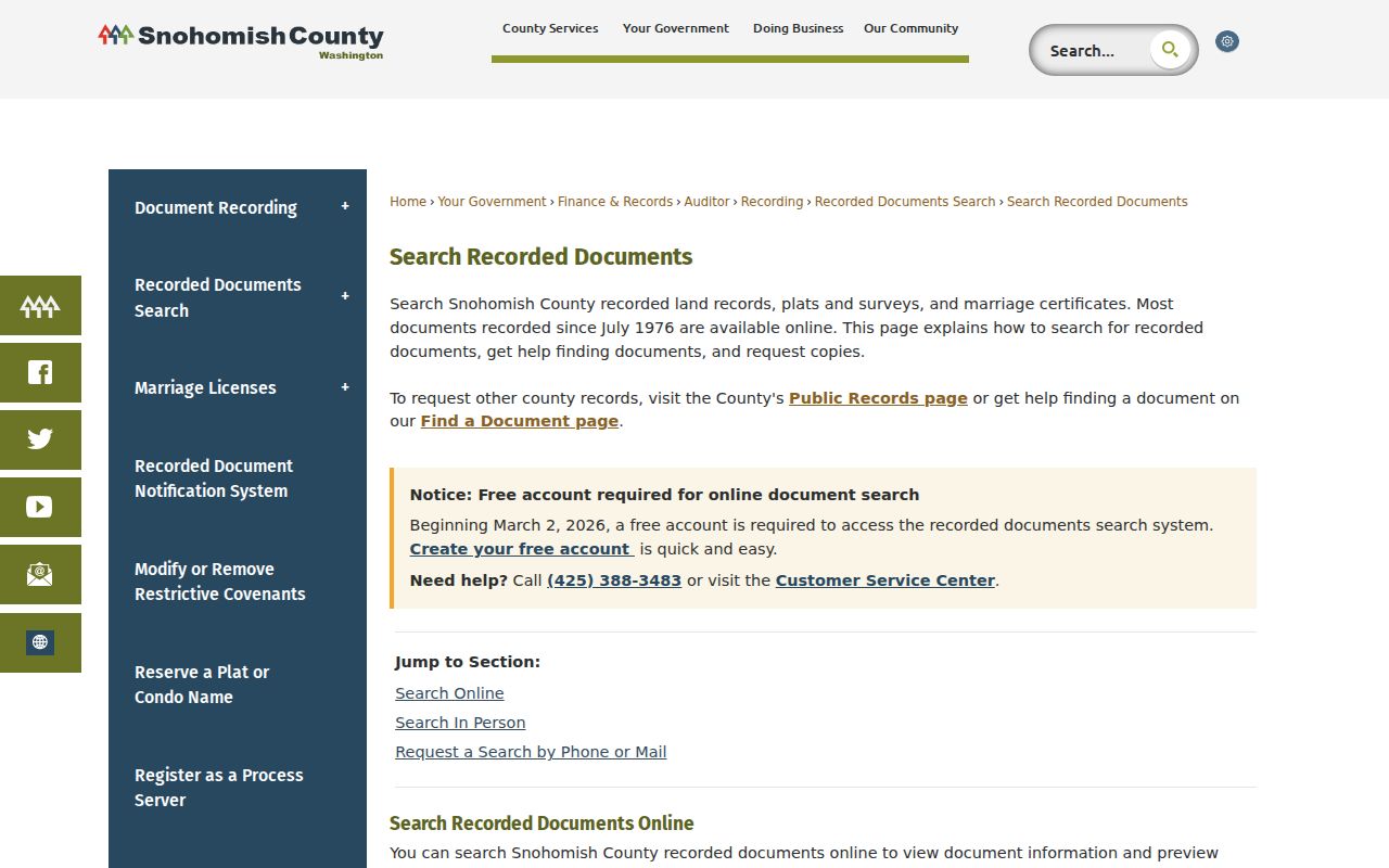
The account gate does not replace the older access channels. Recording has public terminals at 3000 Rockefeller Avenue in Everett, and pre-1976 material is available through microfilm or staff research. Mail requests go to the Recording Division at 3000 Rockefeller Avenue M/S 204, Everett, WA 98201.
Silver Firs Parcel Number Bridge
Snohomish County parcel numbering changed in 2000. A prior deed or card may therefore seem missing even when the address is correct. The Historic Property Information search covers field books from 1970 through 1999. It accepts a 14-digit old or new parcel number, a partial wildcard, or an advanced box number.
Keep the old parcel, new parcel, box, file, and PDF reference in the same timeline. Then search the old number in Recording and the new number in SCOPI. If no scan appears, ask the Assessor whether a paper field book exists. No online result means only that the scanned site did not return a match.
Silver Firs Sector Plats
County summaries list Silver Firs Townhouses and named sector divisions, including Sector 2 Division 9C and several Sector 4 divisions. Their recording dates range from the mid-1990s into the early 2000s. Search “Silver Firs” plus the sector or division in the Recording Legal category. A plat may reveal lot numbers, roads, easements, common tracts, and the original development layout.
Plats organize land. They do not identify occupants. Pair a lot and tract with later conveyances, assessor records, permits, and a dated directory entry before naming previous residents. The sector vocabulary can also rescue a search when a modern street address was not indexed in an older instrument.
One Silver Firs History Marker
Silver Firs Section 2 park offers a small but useful timeline anchor. The county inventory identifies a 0.14-acre park tract at 147th Place SE, dedicated to the county in 1998 beside a transmission-line corridor. Compare the park parcel in SCOPI with its plat and recorded dedication. That can reveal why nearby lots, roads, easements, or common areas have their present shape.
Aerial imagery can date the built setting, but it cannot identify who lived nearby. Keep physical change in a separate column from owner and possible-occupant evidence.
Silver Firs House History Desks
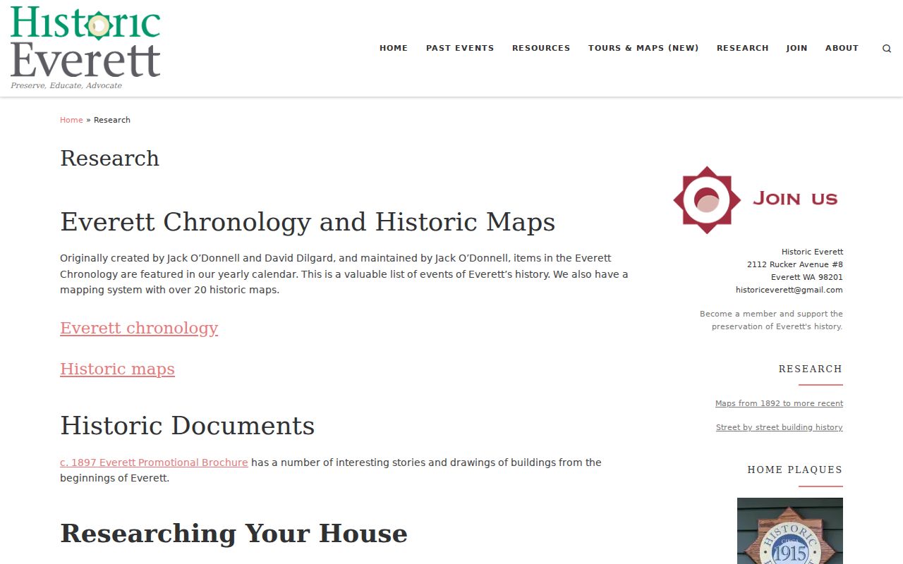
Online land records rarely tell the whole lived story. Historic Everett research assistance and the Everett Public Library Northwest Room list Polk directories, pre-telephone white pages, home files, yearbooks, photos, maps, resident books, and Sanborn maps. Coverage for a Silver Firs address is a question, not a guarantee. Send the address, sector, parcel numbers, and date range before visiting.
The Historic Everett house-history page shown below describes the regional research bridge from an address to directories, house files, maps, and other local sources.
The Snohomish Historical Society archives also offer appointment-based research in title abstracts, obituaries, photos, maps, school records, organizations, and scrapbooks. A focused request asks for one item type and time span. Include old and new parcels, the legal subdivision, names already proved, and an approximate first-conveyance year.
Bridge Silver Firs Directory Gaps
The Library of Congress documents Everett-vicinity criss-cross directories from 1980 through 1995, but 1983 and 1984 are missing. Use the 1982 and 1985 address entries as bookends. Do not assume the same household stayed through the gap. Check a deed, historic assessor card, newspaper, yearbook, or obituary from those two years.
Library property-research notes add a useful warning: “h” marks a home entry and “b” a boarder, but a directory still records residence rather than ownership. Exact Silver Firs street coverage was not confirmed for every volume. Save the publication year, page, printed spelling, and source location for each hit.
Confirm Silver Firs Past Households
Owners are only one part of the history. Dated directories, obituaries, school records, and census schedules can suggest who occupied a home. The full directory holdings are covered on the Silver Firs city directory page. Public federal census schedules currently reach 1950 under the 72-year rule, and much of modern Silver Firs postdates those open household schedules.
- Enter each deed interval as documented ownership, with the ARN and source date.
- Add directory entries by publication year and exact printed address. Mark each as possible occupancy.
- Pair older directory years with an open census schedule only when geography and address agree.
- Use HeritageHub, newspapers, and archive obituaries to check moves, relatives, or death dates.
- Label each person as owner, taxpayer, mailing recipient, recorded party, or possible occupant.
Probate files may close a trail when a recorded owner died. Snohomish County Superior Court records are separate from ordinary public-record requests, and Odyssey may show only case information. Obtain the Clerk's file or order before stating an outcome.
Lawful use. Research Silver Firs previous residents for house or family history, never to track, intimidate, stalk, or harass a living person.