
Walk a Silver Firs Street
Begin with a full street address, not a person. The county assessor can connect that address to a parcel and the owner shown on the current assessment account. SCOPI, the county parcel map, then shows the lot and the parcels around it. Neither source proves who sleeps at the home. Ownership, tax mailing, and residence are distinct facts, so a sound Silver Firs street directory keeps each label and date intact.
- Enter the house number and street in the Snohomish County Assessor search. Save the 14-digit real-property parcel number.
- Open that parcel in SCOPI. Check the legal description, owner, taxpayer, tax-code area, appraisal neighborhood, and adjacent parcels.
- Use VoteWA only for your own registration. Lawful voter-file access follows state rules and is not an open block roster.
- Search the Auditor's recorded-document index by parcel, legal description, and then party name. Record the instrument type and ARN.
- For an older household, consult dated criss-cross directories. Treat each entry as residence evidence, not ownership proof.
This sequence moves from address to parcel to record role. If the goal shifts from a whole road to one name, the Silver Firs resident lookup explains the person-first checks.
Normalize Silver Firs Addresses
Silver Firs is a Census Designated Place, not an incorporated city. An envelope may say Everett, Bothell, or Snohomish while the parcel remains under unincorporated Snohomish County jurisdiction. A ZIP, postal city, precinct, subdivision, and census boundary answer different questions. Use the complete address in USPS lookup, then use SCOPI to settle parcel jurisdiction.
Write down the house number, directional, full street name, street type, postal city, ZIP, parcel ID, and legal subdivision. For an old address, also keep the former parcel number and directory spelling. This small record prevents two similar street names from being merged. It also keeps a postal label from being mistaken for city government authority.
Silver Firs Assessor Search Fields
The Snohomish County Property Information search accepts a parcel number or property street address. It does not offer a separate owner-name input on the inspected form. Less text often returns more useful matches.
| Field | Format | Use |
|---|---|---|
| Parcel Number | 14 digits for real property | Most exact route to one account |
| Street Address | Street name, full address, or wildcard | Find accounts along a Silver Firs street |
| Broad search | Omit direction or street type | Catch spelling and suffix differences |
| Wildcard | Such as 123* | Expand a partial house-number query |
The selected account may show situs address, owner, taxpayer mailing address, values, structures, legal description, and sales. Situs means the physical property location. The mailing address is where tax mail goes, which may be outside Silver Firs and may not identify an occupant.
The live county form shown below makes the address-first design clear. Open the assessor property search before comparing its current fields.
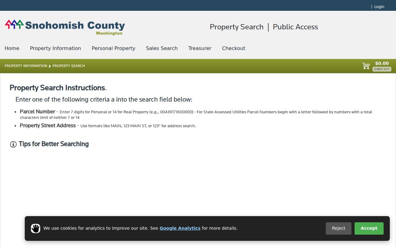
The screen is the starting point for a parcel ID, not a current household roll.
Map Silver Firs Parcels
SCOPI supports address autocomplete, a result list, and parcel detail. Select the address, choose its parcel ID, and retain the property address, owner, taxpayer, gross acres, tax-code area, market value, and appraisal-neighborhood number. The Property Account Summary link adds legal description, structures, tax history, and sales history.
Map layers include parcel lines, labels, appraisal neighborhoods, recent sales, and aerial imagery. The county guide lists urban imagery for 2024 and earlier layers for 2022, 2021, 2020, 2018, and 2017. Those layers can date a road, park edge, or structure. They cannot identify a resident.
SCOPI can display “Multiple Parcels” or a blank account for a shared-interest parcel. That is a local search quirk, not an error. Follow the associated-parcel links before deciding which tax lot matches the street address. The SCOPI viewer pictured here is especially useful when one address touches a common tract.
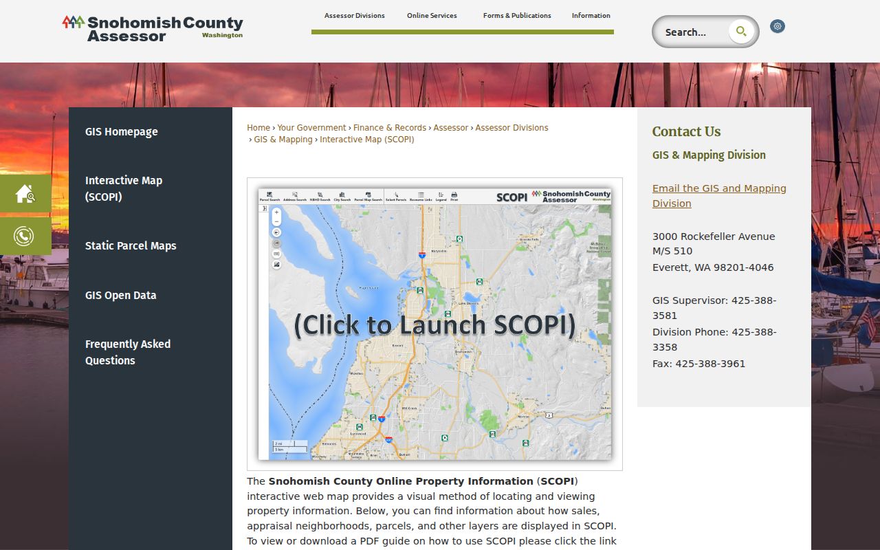
The map gives the Silver Firs street directory a geographic check that a plain address list lacks.
Silver Firs Records by Street
No one source supplies every fact along a Silver Firs road. The best address-keyed sources complement each other. Current portals provide quick access, while microfilm, paper files, and staff requests cover gaps.
| Record Set | Keeper | What It Shows | Access |
|---|---|---|---|
| Assessor account | Snohomish County Assessor | Parcel, situs, owner, mailing address, value | Free parcel or address portal |
| SCOPI parcel layer | County GIS and Assessor | Lot shape, adjacent parcels, aerials, account facts | Free map and parcel click |
| Recorded instruments | Auditor, Recording Division | Parties, date, ARN, deed type, legal description | Account-gated index; copies or counter |
| Historic field books | Assessor archive | Old and new parcel numbers, scanned cards | Online scans for 1970 through 1999 |
| PDS permits | Planning and Development Services | Permits, drainage, grading, land use, occupancy | Portal, records room, or formal request |
The parcel number ties the assessor, SCOPI, deed index, and PDS file together. A street name alone is less stable. Where the current portal lacks an older file, use the office counter, request form, assessor archive, or Recording microfilm instead of assuming the record never existed.
Deeds Along Silver Firs Streets
The Snohomish County recorded-document index searches Name, Document Type, recording number or ARN, Recording Date, Parcel ID, Book and Page, and Legal Description. Names use “Last Name, First Name.” Parcel searches use the first ten digits under the county instructions. Plats, surveys, and condominium records are often easier to find through the Legal category.
Most recorded documents from July 1976 forward are online. A free account became mandatory on March 2, 2026. The detail page can provide the recording date, document type, parties, legal description, and an unofficial preview. Certified copies follow the county order route. Pre-1976 research moves to microfilm at the Everett office or a staff search by mail.
The recording search shown below is useful after the parcel and sector name are known.
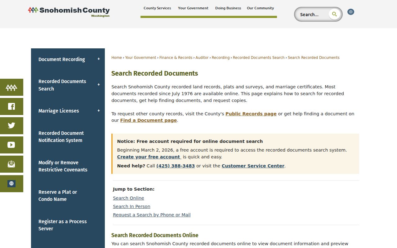
An index hit names a recorded party. It does not, by itself, show that person lived on the street.
The county also offers a free Recorded Document Notification System that monitors a registered name or parcel.
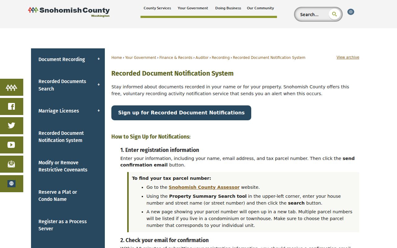
An alert can flag a newly indexed instrument, but the county warns that it cannot guarantee completeness or prevent recording fraud.
Silver Firs Permits by Parcel
Planning and Development Services is a strong fit because Silver Firs is unincorporated. Its Project Status search accepts a project number, parcel ID, or address. Permit files may cover land use, drainage, grading, right-of-way work, code enforcement, fire review, and certificates of occupancy.
The online set is not complete. Many pre-1980 records, commercial files before 2002, active code cases, and some project periods may require the PDS Information Request Form or records room. A narrow request should state the parcel, address, record type, and date range. PDS lists phone 425-388-3622 and InformationRequest.PDS@snoco.org for assistance.
County drainage records describe a 788-acre Silver Firs development footprint with pipes, detention ponds, and discharge near 156th Street SE. That makes drainage and grading files useful for explaining how a road and its lots changed, without turning infrastructure records into claims about residents.
Silver Firs Street Record Terms
A few county terms keep a by-address search precise. Use them exactly when taking notes or requesting copies.
- Parcel
- A mapped tax lot identified by a county number. One address can connect to more than one parcel.
- Situs address
- The physical location of the property, unlike the taxpayer's mailing address.
- Plat
- A recorded map that creates lots, roads, tracts, and subdivision names.
- Criss-cross directory
- A historical directory arranged by address rather than by a person's surname.
Silver Firs sector and division names are valuable legal-description terms. They can find a plat or common tract when the modern street number produces no deed-index result.
Bridge Old Silver Firs Addresses
Assessor parcel numbering changed in 2000. The Historic Property Information search covers scanned field books from 1970 through 1999 and may pair old and new parcel numbers. It accepts a 14-digit old or new number, a partial wildcard, or an advanced box number. A result can include file, old parcel, new parcel, box, and a PDF link.
For occupant evidence, the Library of Congress documents an Everett-vicinity criss-cross run from 1980 through 1995, with 1983 and 1984 missing. Compare a dated directory entry with deeds and historic assessor cards. The historical collections themselves belong on the Silver Firs city directory page.
Do not fill the two-year gap by guesswork. Use the surrounding volumes as bookends, then look for a deed ARN, tax field book, obituary, newspaper, or school record from the missing period.
A Tiny Silver Firs Plat Clue
The county park inventory describes Silver Firs Section 2 park as a 0.14-acre tract at 147th Place SE. It was dedicated to the county in 1998 and sits beside a transmission-line corridor. This small site gives a concrete way to test a street directory workflow: compare the park tract in SCOPI with its original plat, nearby lots, and any recorded easement or common-area instrument.
The exercise shows why every polygon is not a home. A map may display roads, park land, utility edges, detention areas, and shared-interest tracts beside residential parcels. Read the parcel class and legal instrument before treating a map label as a household clue.
Limits of Silver Firs Street Records
A Silver Firs street directory cannot prove every occupant. An assessor row names an owner or taxpayer. A deed names parties to an instrument. A permit may name an applicant. None is a full household list, and a mailing recipient may live elsewhere. Washington motor-vehicle data is restricted under federal law, voter access is purpose-limited, and Address Confidentiality Program participants can use a substitute address.
Record dates also matter. Current assessor data is a snapshot, while a deed remains part of the historical chain after a later sale. When sources disagree, preserve both dates and roles. State the narrow claim the source supports rather than forcing it into a resident label.
Lawful use. Use Silver Firs address records for lawful personal research, and never to track, intimidate, stalk, or harass anyone.